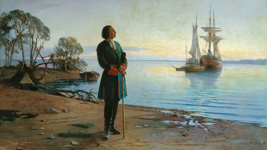
"Nikolai Dobrovolsky", 1880
Nikolai DobrovolskyThe Russian tsar picked the Neva River delta for the construction of the city. This river connects Lake Ladoga – the second largest lake of Russia – with the Baltic Sea. In the 8th-13th centuries, the Neva River hosted the trade route “from the Varangians to the Greeks” – from Scandinavia to the Byzantine Empire.
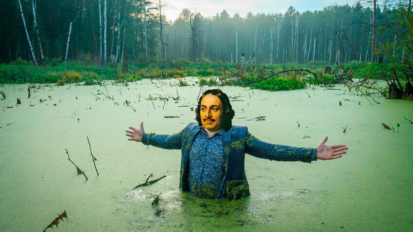
A popular modern meme about Petersburg being built on a swamp
Public domainIn the Finnish language, ‘Neva’ means ‘swamp’; perhaps, this is where the association was born that the city on the Neva River is a “city on a swamp”.
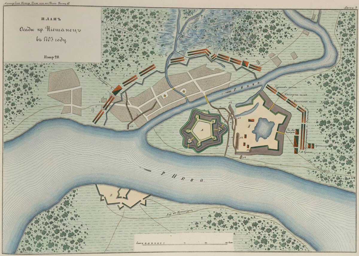
Plan of the siege of Nyenshants Fortress in 1703 by Russian troops. Engraving of 1861
Public domainHowever, this territory has been inhabited from ancient times – and it’s unlikely people would just settle in the middle of a swamp. First, the Finno-Ugric people lived here; then – the Eastern Slavs. Later, these lands changed hands repeatedly between Russians and Swedes. These lands stopped changing hands during the Great Northern War (1700-1721), when Peter the Great finally occupied the territory of the future city in 1703. Before St. Petersburg, the Swedish town of Nyen and its main fortress, Nyenschantz, stood where the Okhta River flows into the Neva River.
Having conquered Nyenschantz, Peter gave the Okhta lands to the builders to settle there. His own fortress – the Peter and Paul Fortress – he founded in a strategically important place, on Zayachy Island. It’s situated in the widest place of the Neva River’s mouth; from this fortress, one could control the fairways of two of its largest waterways.
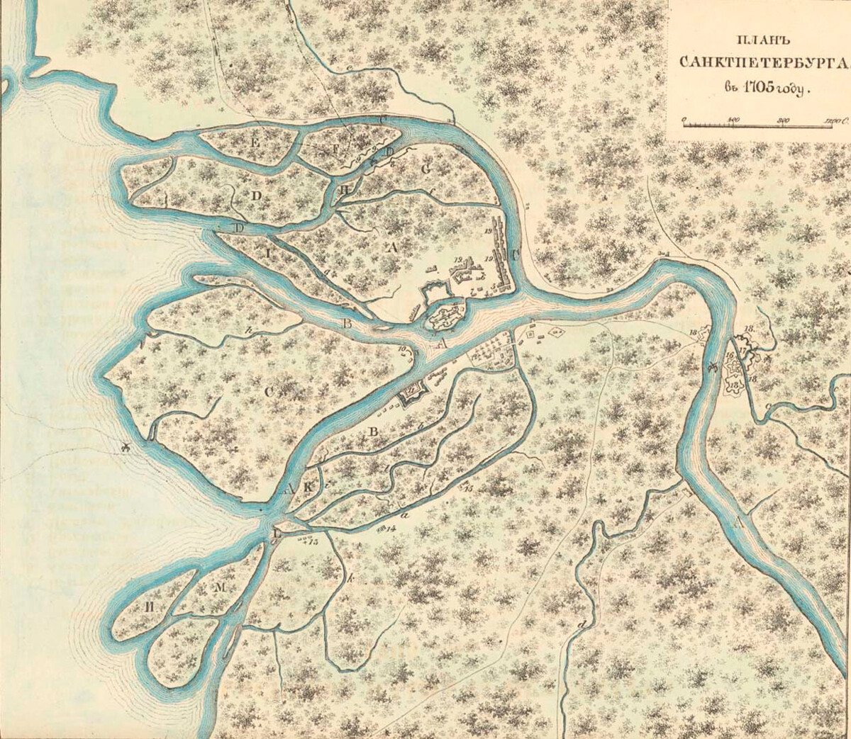
Plan of St. Petersburg in 1705. Historical reconstruction of the 1850s.
Public domainThat being said, the banks of the Neva River arms really were swampy, overgrown with reeds and sedges. During construction, the embankments were piled higher, reinforced with piles and props and “dressed” in granite. The course of the Neva River was also cleaned and straightened.
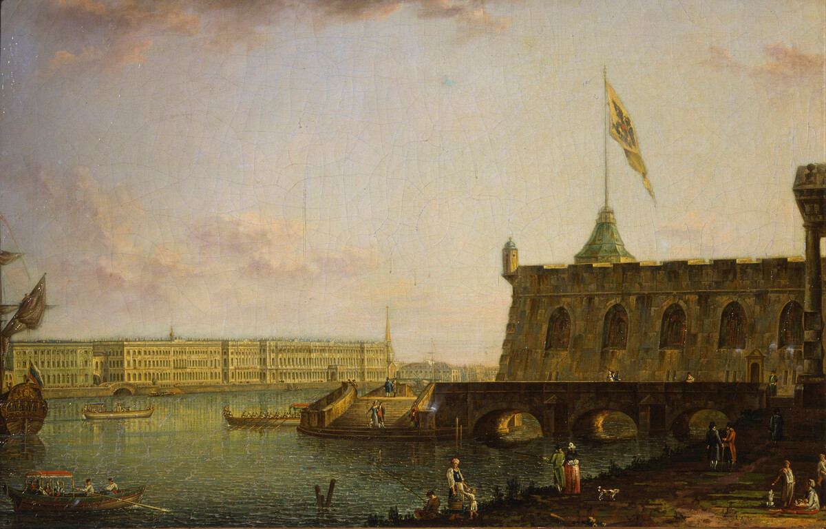
View of the Peter and Paul Fortress and Palace Embankment
Fyodor Alexeyev/The Russian MuseumThere also were swampy areas on the islands of St. Petersburg: on Vasilyevsky Island, on Krestovsky Island, as well as in the area that is now occupied by the Summer Garden and near Nevsky Prospekt. To drain this territory, canals were dug out; small rivers and creeks were filled with earth. By the way, the modern Vosstaniya Square was one of the driest places: a dense forest stood not far from it.
Floods caused many more troubles for the capital than the swamps. The city is located in the Prinevskaya lowland. The central districts of St. Petersburg are just 1-5 meters above sea level. A western wind from the Gulf of Finland always leads to the water level rising in the Neva River.
![November 7, 1824 in the square at the Bolshoi Theatre [in St. Petersburg]](https://mf.b37mrtl.ru/rbthmedia/images/2023.07/original/64abf99dc98fbc0562364ef7.jpg)
November 7, 1824 in the square at the Bolshoi Theatre [in St. Petersburg]
Fyodor Alexeyev/The Russian MuseumThe most destructive floods occurred in 1824 (the water rose to 421 centimeters) and in 1924 (it rose to 380 centimeters). The problem was solved only in the 21 century, when a complex of 11 dams was put into work, with a total length of 23.4 kilometers. It was under construction for more than 30 years, right until 2011.
Read more: St. Petersburg stands on 33 islands! Wait, what!?
Dear readers,
Our website and social media accounts are under threat of being restricted or banned, due to the current circumstances. So, to keep up with our latest content, simply do the following:
If using any of Russia Beyond's content, partly or in full, always provide an active hyperlink to the original material.
Subscribe
to our newsletter!
Get the week's best stories straight to your inbox

