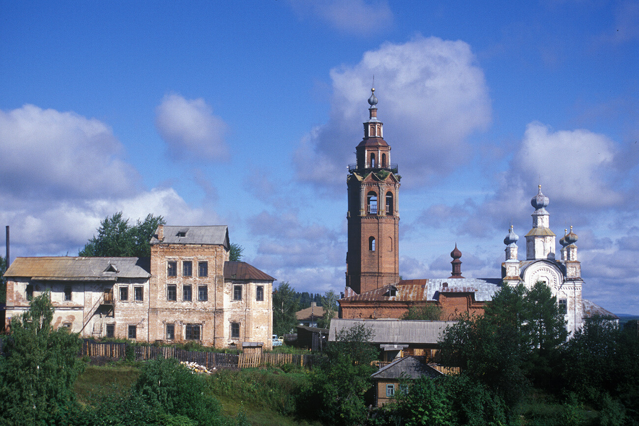
Cherdyn. Church of the Transfiguration (left); bell tower & Cathedral of the Resurrection. South view. August 13, 2000
William BrumfieldAt the beginning of the 20th century, Russian chemist and photographer Sergey Prokudin-Gorsky developed a complex process for vivid, detailed color photography. His vision of photography as a form of education and enlightenment was demonstrated with special clarity through his photographs of architectural monuments in the historic sites throughout the Russian heartland.
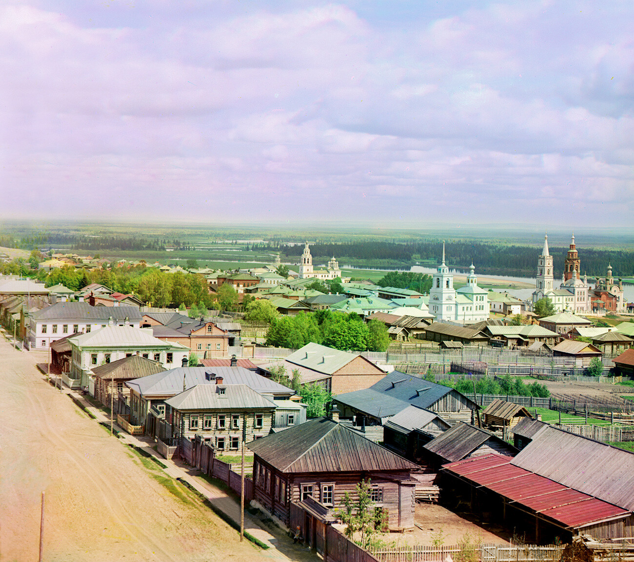
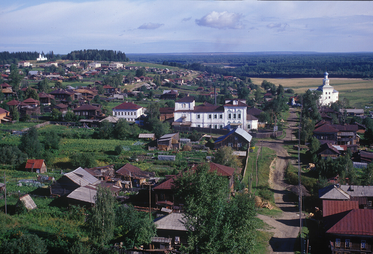
Cherdyn. View northeast from water tower. Churches from left: St. John the Divine; Epiphany; Dormition of the Virgin; Transfiguration; Resurrection Cathedral. Background: Kolva River. 1912
Sergey Prokudin-GorskyProkudin-Gorsky's visit to the Northern Urals, which presumably took place in the Spring of 1912, in connection with the 300th anniversary of the Romanov dynasty, included the small settlement of Nyrob. It was there that the boyar Mikhail Nikitch Romanov – uncle of the first Romanov tsar, Mikhail Fyodorovich – died in 1602 from harsh treatment mandated by Tsar Boris Godunov, who feared the Romanov family as rivals to the Russian throne.
Nyrob is located about 25 miles to the north of the regional center of Cherdyn, settled perhaps as early as the 9th century. Russians (and Orthodox missionaries) moved into the area by the 14th century, but not until the 1470s did the Cherdyn region come under the control of Moscow. The area continued to be subjected to Nogai raids until the conquest of Kazan by Ivan the Terrible in 1552.
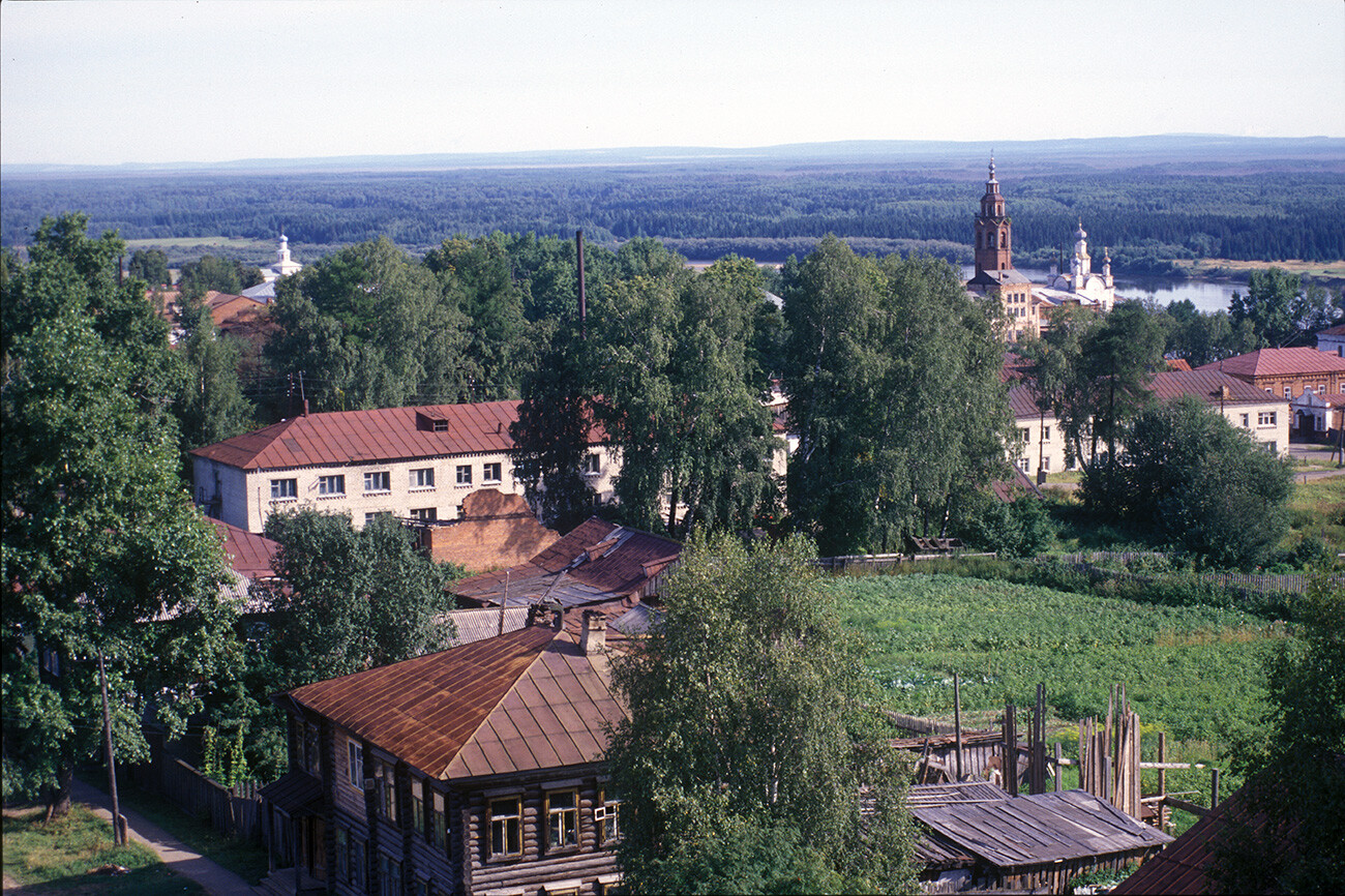
Cherdyn. View northeast from water tower. Churches from left: St. John the Divine; Transfiguration; bell tower & Resurrection Cathedral. Background: Kolva River. August 14, 2000
William BrumfieldThroughout the 16th century, Cherdyn was a gateway for Russian settlers crossing the Ural Mountains to the east. Situated on the right bank of the Kolva River, near its confluence with the Vishera, Cherdyn controlled river passage in several directions: to the north, via the Kolva River, to the Pechora basin; to the south, via the mighty Kama River, to the Volga and Moscow; and to the east, via the Vishera, to the Ob River basin and Siberia.
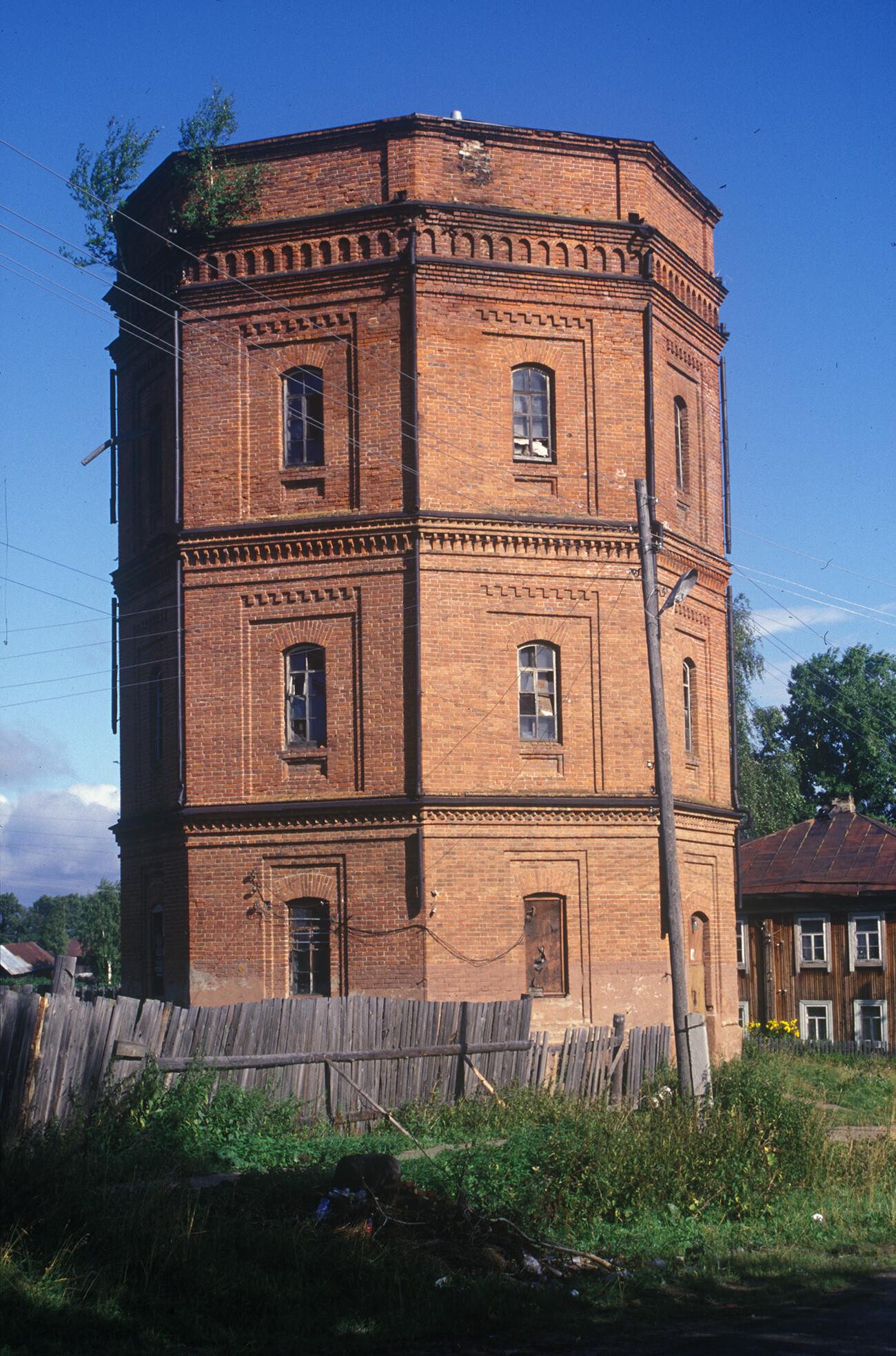
Cherdyn. Brick water tower. August 13, 2000
William BrumfieldAt the turn of the 17th century, a more direct Siberian route via Solikamsk undercut Cherdyn’s strategic position. Nonetheless, it retained regional commercial significance, as reflected by its large churches and merchant houses.
Church of St. John the Divine (1704-18). Southeast view. August 13, 2000
William BrumfieldDespite the loss of most of the church bell towers during the Soviet period, the churches of Cherdyn still provide visual points of reference. This is strikingly evident in a comparison of my panoramic photograph from 1999 with one taken by Prokudin-Gorsky in 1913. Indeed, we both photographed from the top of the same sturdy brick water tower, built in the early 20th century.
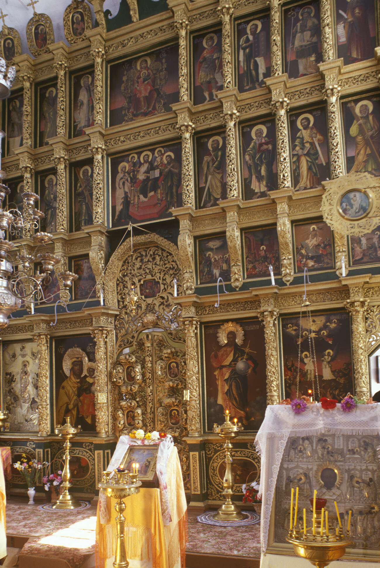
Church of St. John the Divine. Interior, icon screen. August 13, 2000
William BrumfieldCherdyn’s oldest surviving monument is the Church of St. John the Divine, a large church whose construction extended from 1704 to 1718. Earlier, log churches on the site were built as part of the monastery of John the Divine (founded in 1462) and, in 1624, the monastery built its first brick church, the Ascension, which was the earliest masonry church in the Urals.
The present Church of Saint John came into being after a fire in 1700 destroyed the earlier two churches. This large structure, relatively austere in terms of its facade decoration, includes two churches, one above the other and each with its own iconostasis – a frequent practice in the Russian north.
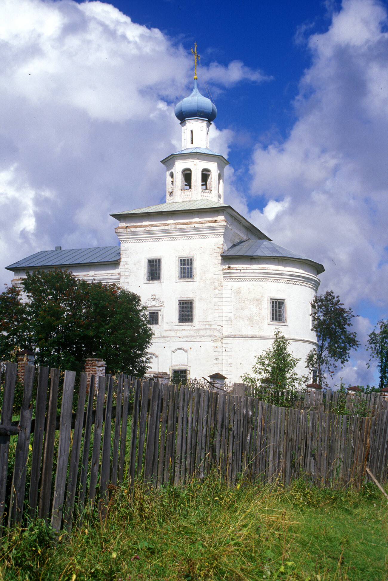
Cathedral of the Resurrection (1750-54) & bell tower (1908-11). Southeast view. August 13, 2000
William BrumfieldMiraculously, the high vaulted upper church has a largely intact icon screen, created in 1734. Although some of the icons date from the nineteenth century, an inscription identifies the original icon painters as Dmitry and Grigory Fedorov from Nizhny Novgorod.
Cherdyn. View north from Resurrection Cathedral bell tower. Churches from left: Church of All Saints; Epiphany Church (1751); Church of St. John the Divine. August 16, 2000
William BrumfieldDespite the many changes effected by Soviet anti-religious campaigns, the dominant architectural form in Cherdyn remains the Cathedral of the Resurrection, whose basic structure was built in 1750-54, with chapels added to the south and north facades in 1751 and 1785, respectively.
Its form represents a mixture of baroque and neoclassical elements, with variations typical of the Russian provinces, from the Volga through Siberia. The unifying element is a large semi-circular gable above the center of each facade. Their contours, naively articulated, define the movement of the design toward the central, elevated dome.
Church of the Dormition (1757-84). Southeast view. August 13, 2000
William BrumfieldBetween 1908 and 1911, the western part of the Cathedral of the Resurrection underwent a major reconstruction and expansion, the most visible element of which was a new brick octagonal bell tower in the manner of the early eighteenth century. The closure of the cathedral in the early 1930s and its subsequent conversion into the regional House of Culture led to the disfigurement or destruction of all the building's religious art. In the first decade of this century, it was reopened for worship.
Church of All Saints (1815-17), southwest view. August 14, 2000
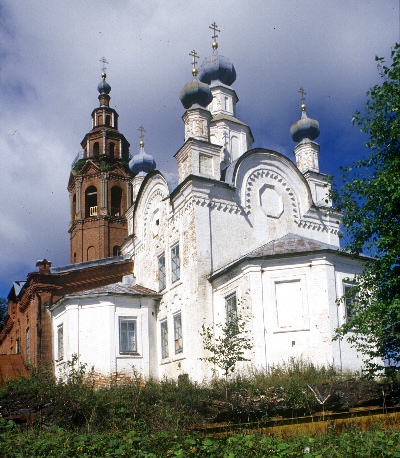
William BrumfieldTo the west of the Resurrection Cathedral stands the Church of the Transfiguration, built in 1756 in a simpler style, but with many of the same compositional elements. In 1853, a large new bell tower, built at the request of the parishioners, replaced an earlier one and became the dominant vertical center of the entire town. With the closing of the church in the early 1930s and its conversion into a forestry technical school, the cupolas were removed and the bell tower was gradually dismantled – a process that lasted until the early 1950s.
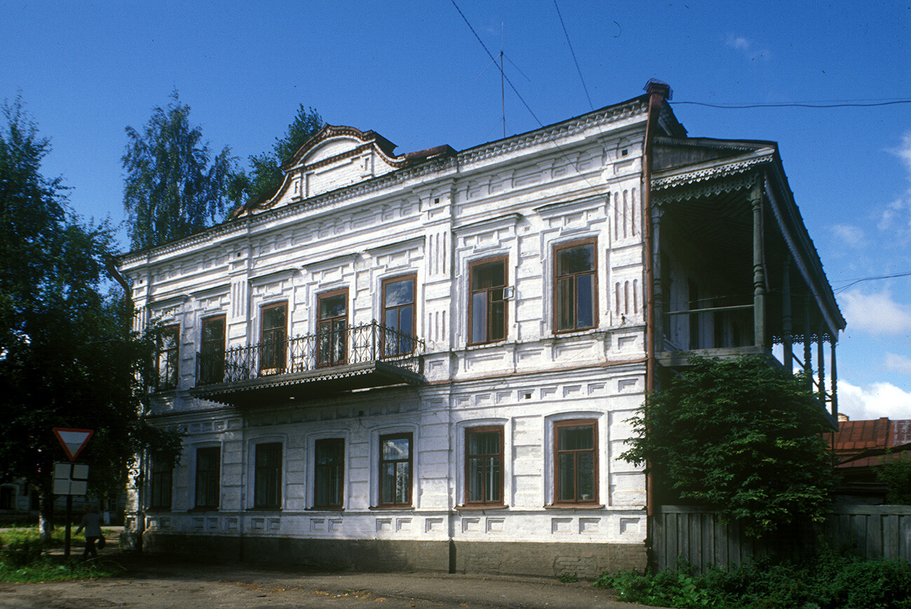
E. N. Chernykh house, Engels Street 21. August 13, 2000
William BrumfieldFarther to the west of the riverbank and between the monastery and cathedral complex was the third of Cherdyn's large churches, the Epiphany, completed in 1751. The church and its three altars withstood damage from the fire of 1792. At the end of the 19th century, its bell tower was rebuilt. The bell tower and the cupolas were removed during the Soviet period when the church was converted to a bakery.
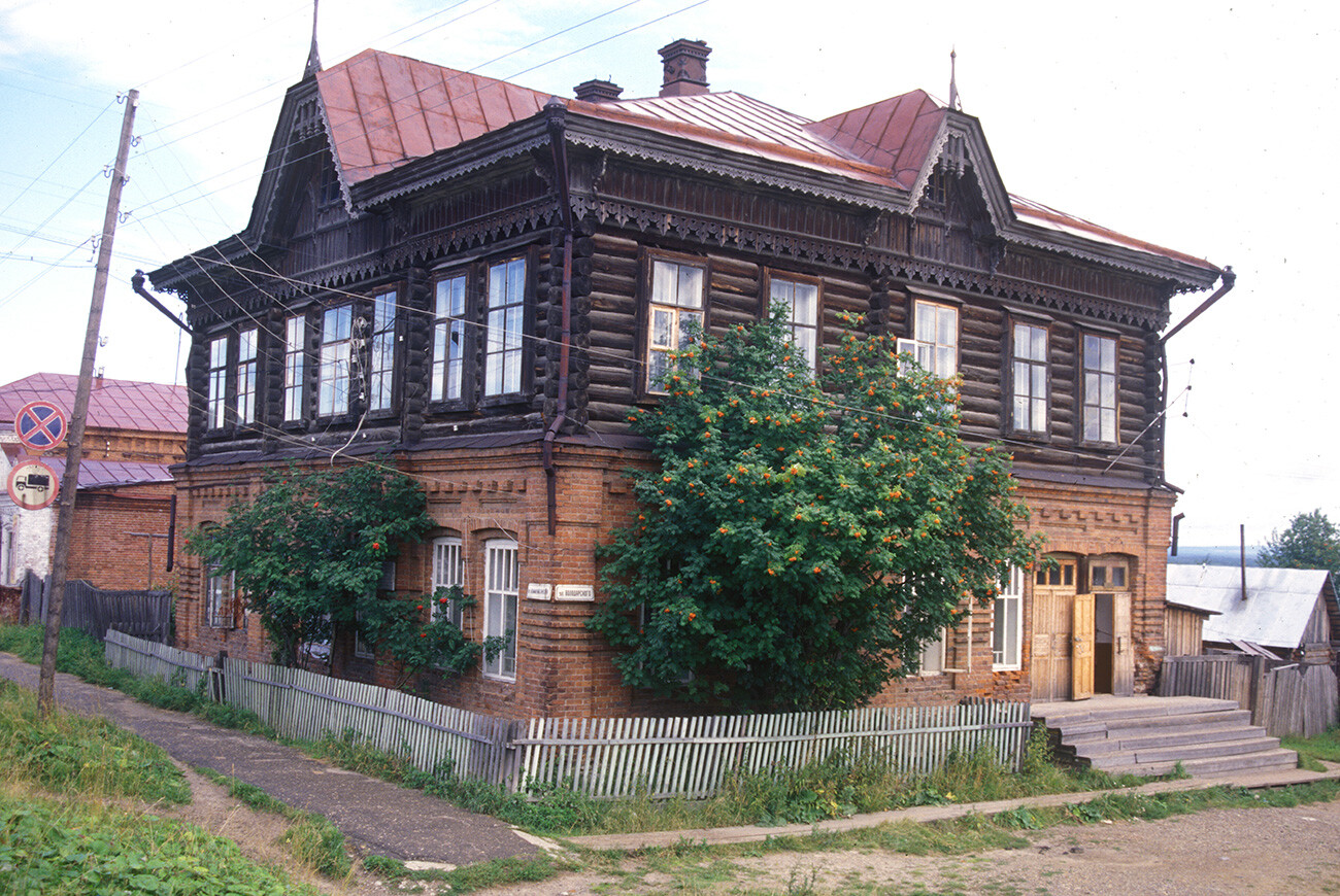
Yaborov house, Volodarsky Street 13. August 13, 2000
William BrumfieldThe final church of the central ensemble is also the smallest and most refined in its detailing: the Church of the Dormition, completed in 1784. After the closing of the church in 1932, its cupola and bell tower were removed, and it stood empty until its acquisition by the Museum of Local History in the mid-1950s. In the Fall of 2000, it reopened as the Museum of Religious Belief.
P. Zyryanov house, Communist Street 78-80. August 13, 2000
William BrumfieldOn the northwest outskirts of Cherdyn is the diminutive cemetery Church of All Saints, built in 1815-1817. This simple traditional structure has been conserved by the regional history museum.
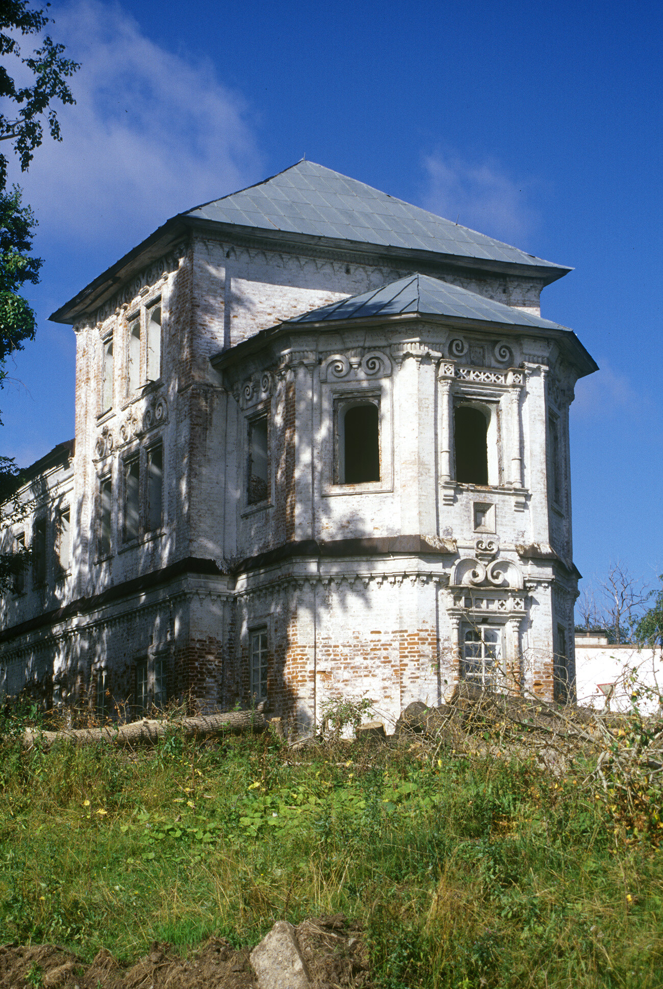
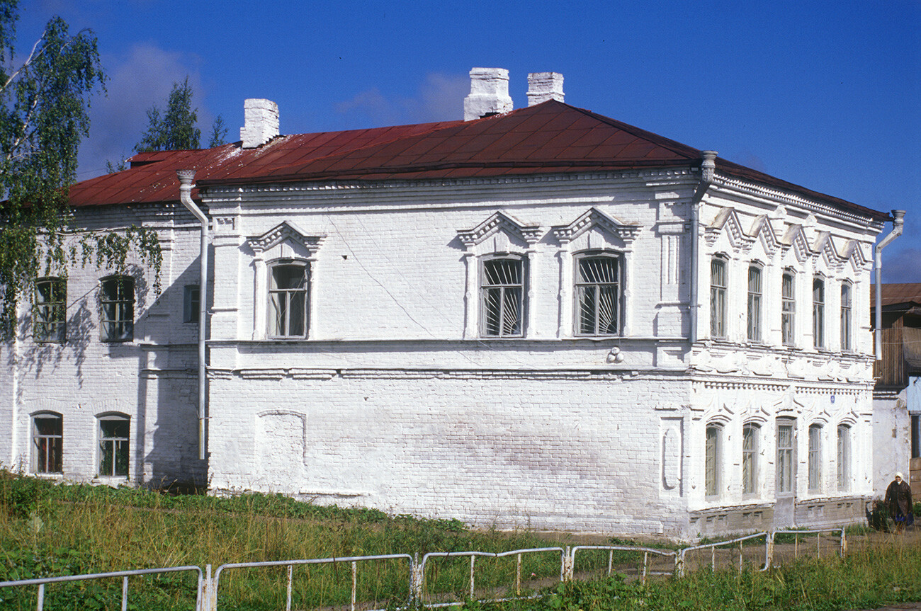
A. A. Golovin house, corner of Communist Street 73 & Volodarsky Street. August 15, 2000
William BrumfieldThe town plan follows the grid pattern created after the great fire of 1792 by the Commission for Masonry Construction in Saint Petersburg and Moscow. Catherine the Great supported the development of orderly plans for Russia's provincial cities, and many of them were implemented with great skill in the latter part of the eighteenth century. In the case of Cherdyn, the architect Ivan Lem, who worked in towns along the upper Kama River, devised a plan that took into account the hilly relief and the surviving churches as architectural dominants.
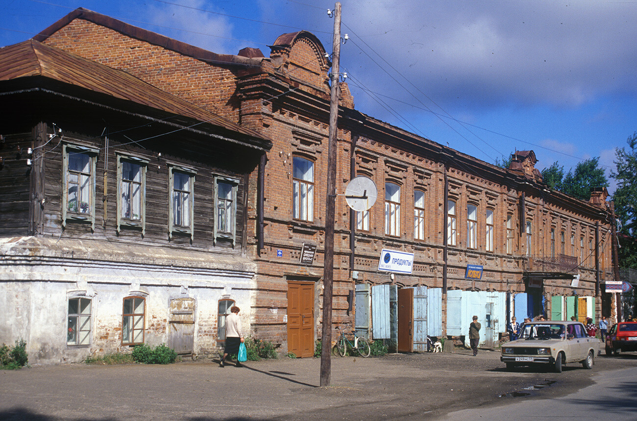
Municipal Building & Brothers Ossovsky Store, Dormition Street 70. August 13, 2000
William BrumfieldToward the end of the 19th century, local economic activity experienced a strong revival, helped in no small measure by gold mining in the nearby Vishera River basin. A further boost was provided by the observance of the tercentenary of the Romanov dynasty.
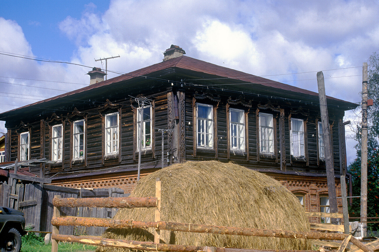
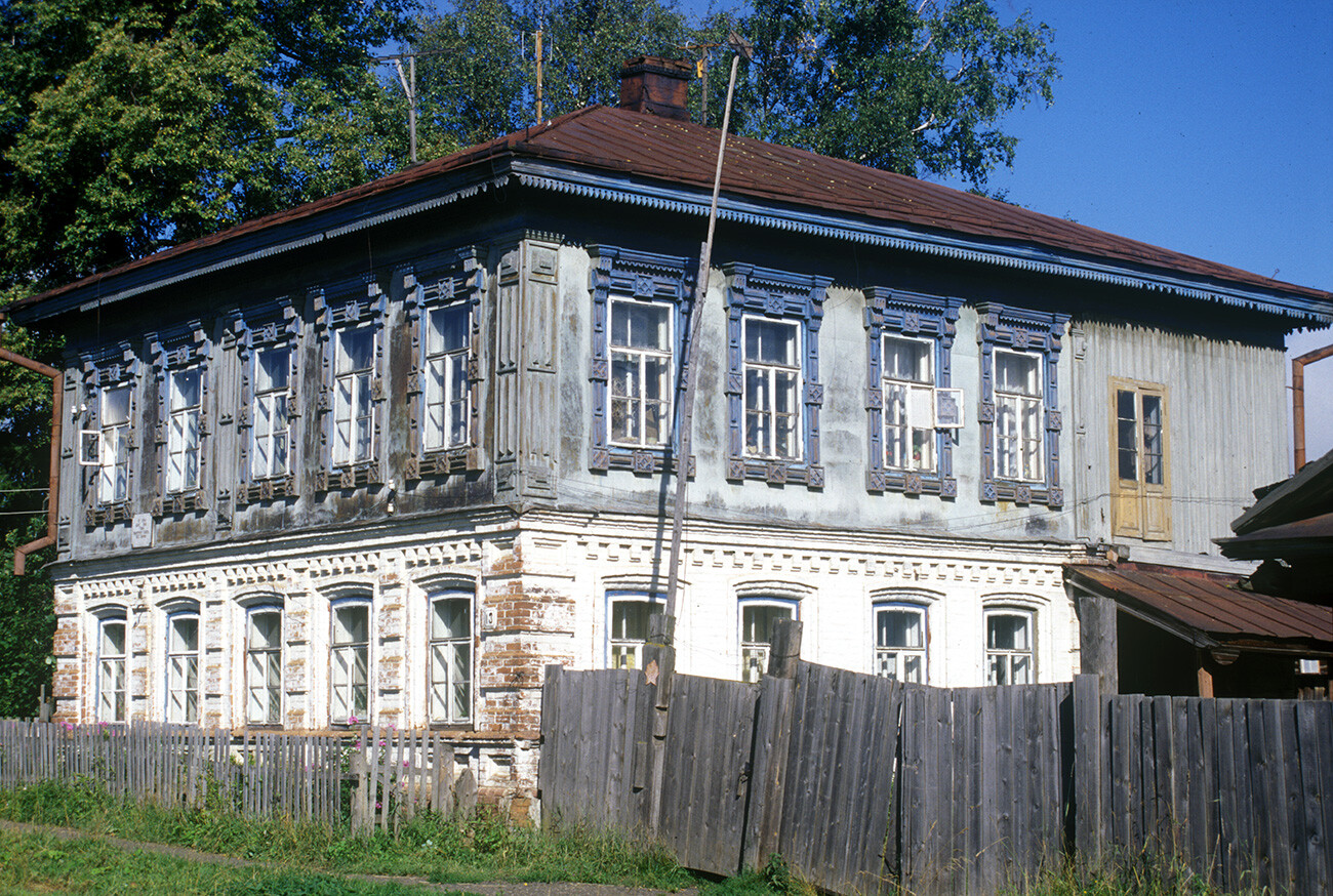
Wooden house on brick ground floor, Mamin-Sibiriak Street. August 13, 2000
William BrumfieldThe town gained several new brick buildings, including three schools and a hospital, as well as numerous houses whose form has changed little since the late 19th century. Many of these houses are built of logs, with a brick base or first story. Others were built entirely of brick, frequently with balconies and loggias.
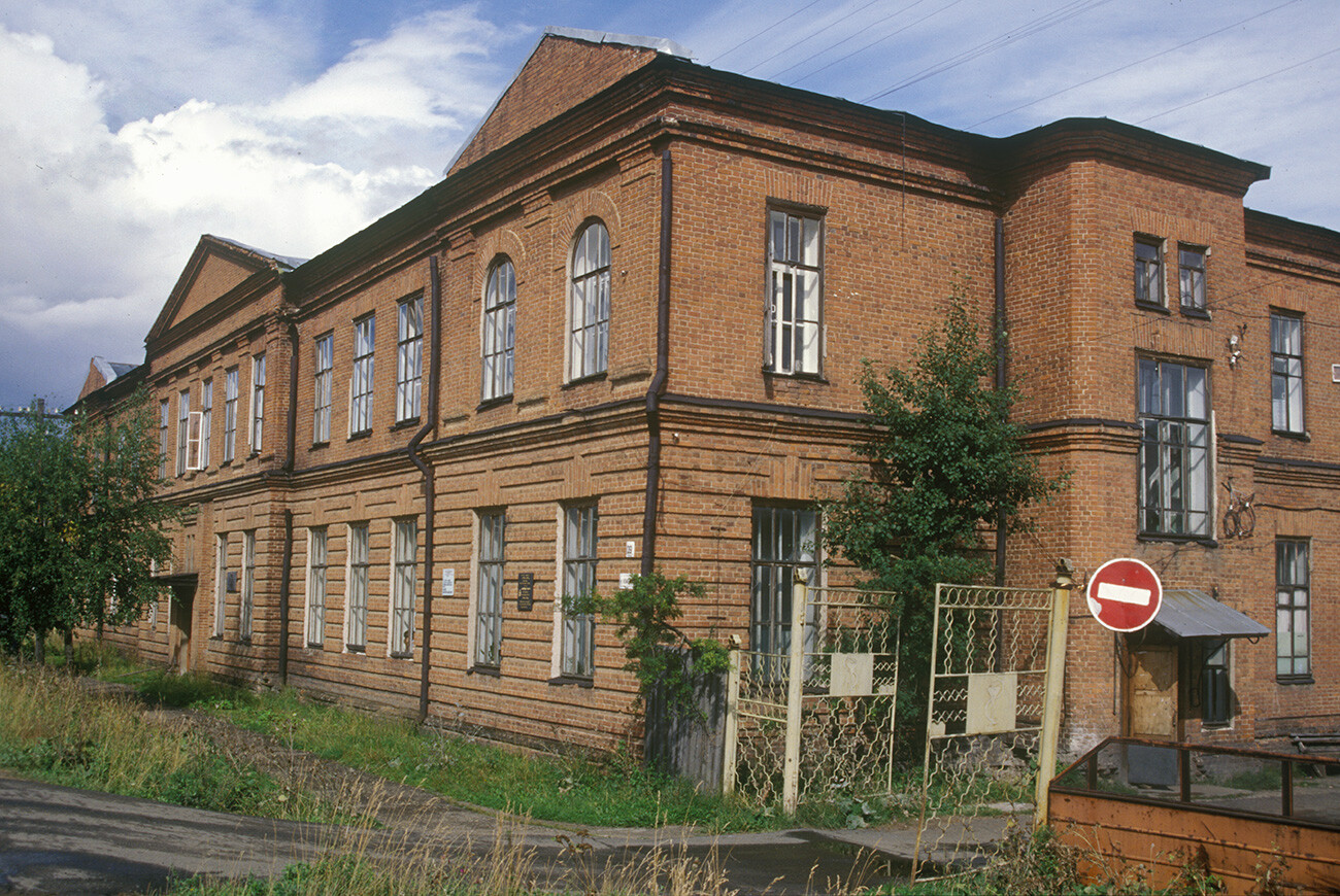
Regional Hospital, Komsomol Street 39. The poet Osip Mandelstam was briefly here as an exile in 1934. August 16, 2000
William BrumfieldThe red brick regional hospital, constructed in 1913, has a stone marker on the main facade commemorating the great poet Osip Mandelstam (1891-1938), exiled to Cherdyn in 1934. He and his wife Nadezhda spent only a few weeks there. After his attempted suicide in this hospital, he was permitted (still within exile) to move to the city of Voronezh.
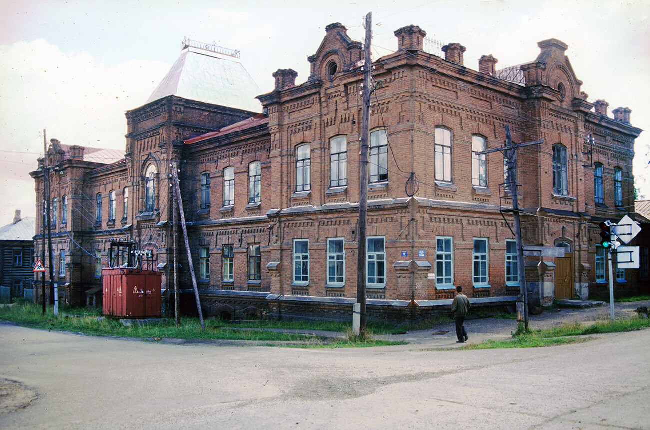
Trade School, Komsomol Street 43. August 14, 2000
William BrumfieldSurrounding Cherdyn are small towns and villages such as Vilgort, Kamgort and Pokcha. Each of these settlements has its own monuments, often in a state of disrepair, but, nonetheless, picturesque. The most unusual is Pianteg on the Kama River, with its archaic hexagonal Church of the Epiphany. This is perhaps the oldest wooden structure in the Urals, built according to some sources as early as the late 16th century.
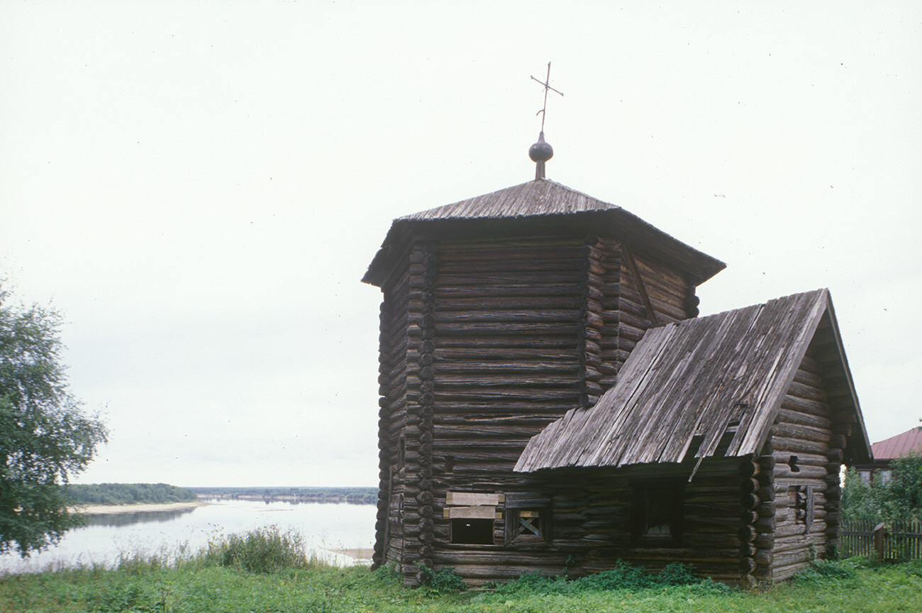
Pianteg. Log Church of the Epiphany, southeast view. Built perhaps in early 17th century; considered the oldest surviving wooden structure in the Urals. Background: Kama River. August 15, 2000
William BrumfieldAnd, to the south, is Solikamsk, with its array of stunning churches. From Solikamsk to Cherdyn to Nyrob, the historic towns of the northern Perm Region form a fascinating itinerary for the intrepid traveler.
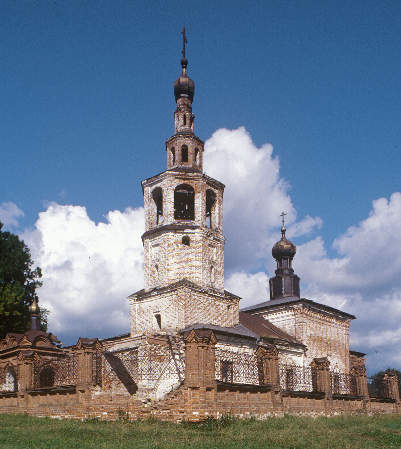
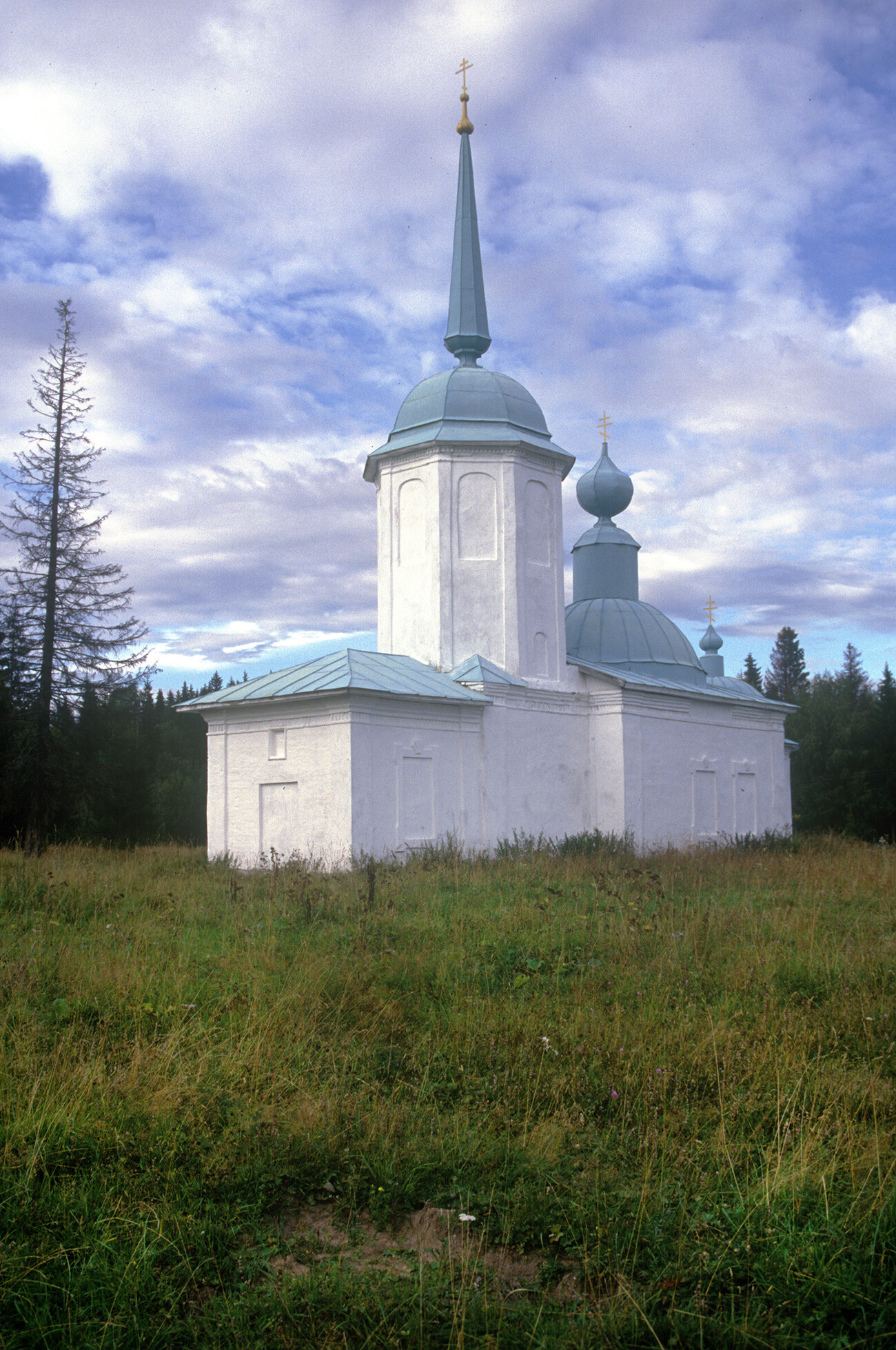
Iskor. Church of Nativity of Christ (1782-93), southwest view. August 14, 2000
William BrumfieldIn the early 20th century, Russian photographer Sergey Prokudin-Gorsky developed a complex process for color photography. Between 1903 and 1916, he traveled through the Russian Empire and took over 2,000 photographs with the process, which involved three exposures on a glass plate. In August 1918, he left Russia and ultimately resettled in France where he was reunited with a large part of his collection of glass negatives, as well as 13 albums of contact prints. After his death in Paris in 1944, his heirs sold the collection to the Library of Congress. In the early 21st century, the Library digitized the Prokudin-Gorsky Collection and made it freely available to the global public. A few Russian websites now have versions of the collection. In 1986, architectural historian and photographer William Brumfield organized the first exhibit of Prokudin-Gorsky photographs at the Library of Congress. Over a period of work in Russia beginning in 1970, Brumfield has photographed most of the sites visited by Prokudin-Gorsky. This series of articles juxtaposes Prokudin-Gorsky’s views of architectural monuments with photographs taken by Brumfield decades later.
If using any of Russia Beyond's content, partly or in full, always provide an active hyperlink to the original material.
Subscribe
to our newsletter!
Get the week's best stories straight to your inbox

